
 |
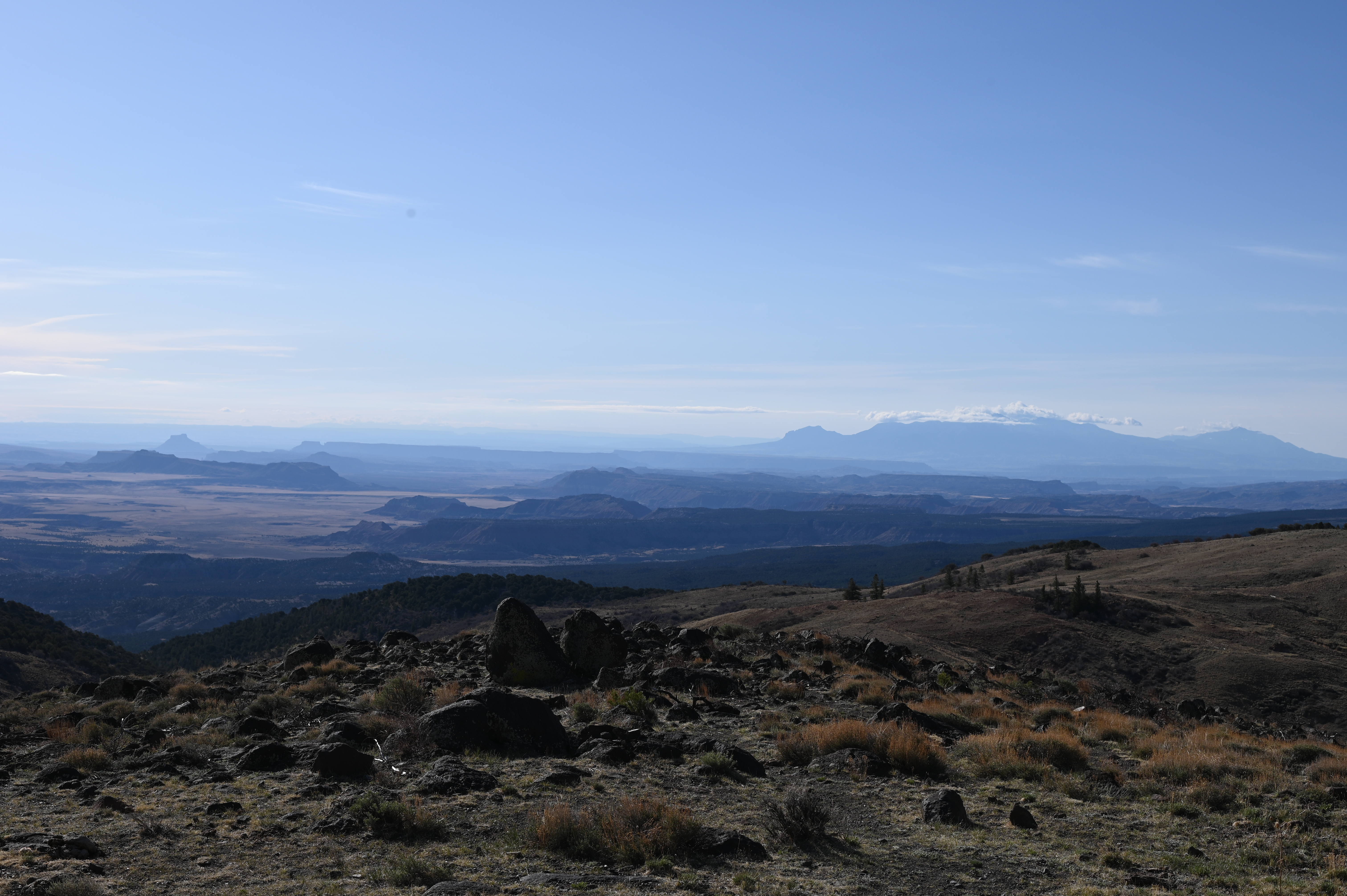
| Elevation just shy of 9,000’ looking into the Southern Utah backcountry |
April 30 - May 2, 2025, (Finished) Trip Notes
It's a week before the trip, I'm sitting at the Subaru dealership, the Forester is getting an oil change, and their waiting area has good coffee and snacks. I've written other stories here and it's a great way to pass the time while I wait for my Forester to be serviced. The trip date into Southern Utah has come up on me fast, but that is how life and time is as I get older, everything is faster, and I revel in the times when I am bored, and time slows down... I'm enjoying creating the blog and more than that, I am grateful for my life as my family is doing well, relatively speaking.
I'm well on my way, the plan detailed here at the idea. I've invested in a new to me lens, it's actually about 40 years old and made by Nikkor or Nikon. It is a 15mm lens or a super wide angle, or a fisheye except that it doesn't bend the image, it just captures a very wide angle. I can be a foot away from a wall pointing straight at it and my feet will show in the image and the image is not distorted. I've always been intrigued by them and now that I'm well on the way of photography, it was time for me to bring one into my kit. I will primarily use it for indoors but there are a couple of shots that I want to get with it on my trip to capture the pictographs and petroglyphs of Southern Utah, just for one, I'm thinking it will be the Rochester Panel standing close but getting the whole panel in frame.
Last Friday I had the windshield of the Forester replaced, this Friday, oil change and checking out the passenger side rear view mirror. It has a slight rattle and bothers me at speed as it makes my eyes feel like they are not in focus, but they are. I'm going through the list in my head of what I'll need, the trip is only a few days, yet I'll be spending quite a bit of time on the road and at the destination, lots of that time will be on county or dirt roads.

I've been stressing on navigation. My iPhone is the latest version however, my phone plan is good, but it is a metro plan. Once I leave the city, cell coverage is spotty. My GPS works in the phone, yet it gets wonky if the destination is closed or lost and it wants internet connectivity. I remembered the time I sought to catch trout in Kauai. Dense jungle, no cell service and I used the GPS mapping app, Gaia. I downloaded the app again, logged in and up came my prior trips. I bought the premium version which allows me to download all kinds of maps offline and my iPhone GPS no longer needs that internet connection and as a bonus, it works in CarPlay, the Subaru head unit interface that projects the map and trip data on my dashboard screen. I have two forms of back up, an actual paper map that has all the trip data on it and my Garmin car GPS that has the info programmed. The paper map will live in the gap between the center console and the passenger seat for quick looking and the Garmin will continue to live under the driver's seat in its storage case. I've studied the maps enough to know the birds eye view in my head, and I'll operate with my iPhone and Gaia as that is my preference. That was a huge weight lifted off my plate, that and lodging. I have the first two nights booked, the last night I may car camp or find a place.

I've decided to condense the trip notes here. I'll write about the trip and then add in the trip highlight photographs here and at the different areas, I will do photograph pages with links back to this page for the story. So eventually, everything will be interconnected and even the idea page will have links to the journey.
The journey being as important if not more important than the destination.
Originally, Buckhorn Wash Pictographs where not in the plan. I've been having trouble putting together a tour as directions to each area are typically detailed yet they are far down county or country dirt roads, most are drive up areas but putting together a good tour that matches the type of images that I want to see so far away is a bit difficult. I keep imagining the timeline of the trip, do I have this right? Am I biting off more than I can chew? I do have a contingency however the four petroglyph/pictograph areas in three days including drive time are a huge endeavor. I am coming back on Saturday, if the timeline is too aggressive, I have another night I can stay and drive back home Sunday. At my farthest point, I am ten hours away by dirt road, highway and such.
One of the reasons for this post so early before was to run this by my wife, she knows me, and I got the ok from her. I'm quite surprised as she is safe and a rule follower. On a previous trip to the Big Island of Hawaii, we decided to visit the observatory on Mauna Kea at almost 14,000' It is a drive up with a stop at around 9 or so thousand feet. The docents there warn of bringing children up as we go from sea level to 14,000' very quickly. I really wanted to go and my wife being a nurse, and a very careful person said, "let's do it" and looking back, it wasn't Noah that was the problem, it was me. I remember being a little lightheaded and my lips were a shade of blue, I don't have any heart or lung issues, I'm just getting older and I'm not in the fighting shape I once was...
But everything is good now and I'll pack the car Tuesday night, go to work and drive away from work on my goal of capturing images on my petroglyph odyssey.

--------------------
I’m back from the trip and a couple of notes.
Cell phone service was OUT most of the time in the back country. I was able to still navigate with Google maps.
Also, I was conservative with times at sites. What happened was my time on site went much quicker. The drive time was accurate but the time in between was too conservative. I ended up doing all the sites in one day. So I came home early by one day.

Total drive miles was 1297 and that was done just shy of 48 hours. I drove halfway starting Wednesday at 4:15p and I spent the night at a hotel. I got up at 5a and drove the rest of the way into the area, made all the sites for that day early. I took a nap and completed the last site that late anfternoon and went to the hotel very tired but ready to drive home in the morning. Looking at the map to see if there was anything on the way, I discovered Newspaper Rock was just 12 miles off course and it looked interesting. So I drove there first, then Monument Valley and then home. Newspaper rock ended up being one of my favorites.
Total trip statistics was 1297 miles broken into 6 site stops in 46 hours.
UT Petroglyph and Pictograph / Monument Valley Tour
#1 Rochester Panel Petroglyphs
Weds Eve, April 30: 5 hours to Page area - Rodeway Inn & Suites - 605 S Independence Dr, Big Water, UT 84741
Thurs morning, May 1: 4 hours drive to Rochester Panel - 20 min easy hike. - Drive to Molen Reef Petroglyphs- Drive to Buckhorn Wash Pictograph Panel exit 131 N for 23 mi
Thurs afternoon: 40 min drive to Motel 6 in Green River, UT - 1860 E Main St, Green River, UT 84525, nap, drive to Sego Canyon and back to the hotel.
Fri morning, May2: 5:30a up and drive to Newspaper Rock, then to Monument Valley and home by 2:30p.
 |
| Newspaper Rock Petroglyph Site |
--------------------
Pack List
Map
Garmin GPS (program stops)
Aluminum Table
Kitchen Box - Spice - Utensil Bag
Chair
Yeti Cooler
Coleman Jug
Jerry Can Water
Inflatable Mattress
Insulation Mat
Pillow
Quilt
Camera bags
Tripods
Duffle and Clothes
Backpack
Groceries
Water x 3
Starbucks Ice Mocha x 2
Milk
Lucky Charms
Dehydrated Eggs & Bacon
Dehydrated Meal x 2
Wonder Bread
Smoked Turkey
American Cheese
Mayo
Mexican Cokes
Rum
 |
| Forrest Gump spot, “I think I’ll go home now.” |
No comments:
Post a Comment